All-Around Angler: How to Read Maps to Find Fishing Spots


My introduction to the power of maps as divining rods for fishing spots came when I was 14 and my family roadtripped from Seattle to Homer, Alaska, and back. My parents would let me fish about once per day, so I spent hours upon hours in the back seat scouring theMilepost guidebookand the B.C. and Yukon atlases to pick the very best creek or lake for my precious few minutes.
Digital scouting has become soubiquitous among huntersthat most of us wouldn’t be caught dead going into a spot without spending a good hour or two scouring it withonXmapsor Google Earth. These tools are so valuable and simple that it sometimes baffles me how so many anglers will head out to new waters with nothing more than a tip from an online forum and a positive attitude that they’ll figure it out.
That’s all well and good, and I certainly enjoy the challenge of solving a new fishing puzzle, but I get more, and more productive, time on the water when I have a basic plan before I even leave the house. Over the years I’ve developed three primary river, lake, and inshore features that I look for on digital or paper maps prior to fishing. I call ‘em the three Cs: constriction, confluence, and corners. To some, these may seem obvious, but I find them a useful frame for analyzing water. When you have many miles of river or acres of lake to dissect, keeping these three basic factors in mind will help you flag promising areas.
If you’re at home anxiously planning your next fishing trip, take a digital flyover of your hallowed waters. Pay attention to specific geographical features to maximize your fishing time and minimize your time driving around in the truck or boat.
Constriction
Think of constriction on a map as the stem in between the two chambers of an hourglass, the spots where a river, lake, or sound narrows. This might also be called a pass, dam, weir, neck, rapid, falls, isthmus, saddle, or narrows. It can be the tight opening from a cove into a main lake, the passage between two ponds, the slot canyon that a river flows through and picks up speed. These bottlenecks concentrate fish as they migrate or try to find prey. They also provide staging or ambush locations on either side.
In rivers, reservoirs, and saltwater, constriction means current. While some fishes do gravitate toward stronger flows, many more species have a high affinity for places right below strong current. The water will be more oxygenated, the current will often dig deep holes where it peters out, and food will be concentrated and sometimes disoriented as it washes out of whitewater. Migratingsalmonandtroutwill regularly stage or hole up below a rapids or waterfall, regaining strength or waiting for the right flows to make the ascent.Smallmouthandcatfishlove sitting in the slack water below rapids, waiting for wounded baitfish to wash out. And if you didn’t know that the tailraces below dams were hotspots for everything frommuskiesto shad tosturgeon, you probably haven’t been fishing very long.
In lakes or inshore saltwater, constriction points are favorite haunts for predatory fish. And let’s be honest—most of the fish we care much about catching are predatory. The pass between two islands may be where asnookorredfishis holding, waiting formulletand shrimp to wash through. The mouth where a bay opens into a lake is a likely spot to find a bigpikeorlargemouthwaiting to ambushbluegillas they head for open water. Shallow water and thin passages condense and slow fish on daily or seasonal migrations, much like a string of toll booths on a highway. It’s the same concept astargeting terrain saddlesin pursuit of elk or deer.
Find the spot where a river gets thinner then opens up, or piles up behind an obstruction like adam. Look closely at the narrowest point on a lake. On a more microscopic level, try to find the tight channel between a point and an island or the trough between two shoals.
Confluence
I’m a moving water junky, and any time I’m on a stream, I’m looking for spots where another stream flows in. It could be a tiny trickle of a tributary or the larger fork of the same river. The same principle applies to any water flowing into saltwater or out of a lake. Confluences concentrate fish.
Most every fish species has a range of water temperatures they find comfortable. Tributary inflows can help fish thermoregulate by providing a seam of colder or warmer water to find their sweet spot. During high water runoff, creek mouths often provide a strip of clean, clear water and escape from the muddy main river flood. I can’t count how many times I’ve found trout,steelhead, salmon, and smallmouth in a 30-yard creek seam when the rest of the river was completely flooded and unfishable. During low or warm flows, smaller creeks sometimes bring in colder water, especially from springs.
Tributaries often deliver different food sources to lakes or rivers, whether it be different insect hatches or outmigrating smolt. And many fish species spawn in smaller waterways, so the mouths of those creeks are often the best place to intercept migratory fish. Estuaries and deltas where freshwater meets salt are usually the most prolific and biodiverse hotspots in an entire region, especially where anadromous and catadromous fishes exist.
Practically speaking, when I’m scanning onX on my phone or any old road map for a spot to pull over and fish, I’m always looking for places where one waterbody joins another. Then I get to fish two streams, or a stream and lake, or a stream and a bay, from one pullout. This provides a higher-than-normal likelihood of fish in the vicinity.
Corners
Whether they be concave or convex, prominent corners in a waterbody are frequently great fishing spots. I don’t need to tell many of you thatwalleyelike rocky points and spawning crappie like little coves. However, the fact that river hydrology often creates deep holes wherever the current makes a prominent hard turn may be less apparent. Similarly, the bend in an inshore sound or the point of an island will also create troughs and shoals that concentrate migration and/or predation.
While the productivity of corners in a shoreline will likely come as news to no one, far fewer anglers think about them in terms of underwater terrain. This has become increasingly apparent as I’ve gotten more and more into ice fishing the last couple winters. When you can’t easily troll or drift from one point to another, you need to target your efforts on the best possible waterscape features. Out in the middle of a giant lake, we’ve foundlake trouthanging around the biggest point off a mid-lake plateau in 80 feet adjacent to 150. In a smaller reservoir, we hammeredyellow perchin the main bend of the old river channel, where the bottom drops to 25 feet from the surrounding 15. Certain types of maps are more useful for locating these sorts of characteristics and well worth your time to find, purchase, and scour.
Types of Maps
The best type of map an angler can get isbathymetric, the underwater version of topography. Each line ringing the waterbody denotes a specific depth, descending from the shore by a fixed unit of measure. Thus, lines close together or touching indicate a steep slope or dropoff, while lines spaced far apart show a shallow slope, a flat, or shoal. Where the lines descend to a center point or circle, that’s the deepest hole. Where the lines rise in a cone, that’s a pinnacle, hump, or rockpile—places to jig for walleye, crank for bass, drift for halibut, and anchor fortarpon.
Bathymetry changes more than topography. I’ve had depth maps of lakes appear wildly inaccurate and assume the sounding was done during a different water level. Out ice fishing this year on a big reservoir, the bottom in actuality was some 25 feet shallower everywhere than the map said, probably because it was mapped long ago when the reservoir was first flooded. The overall picture of the underwater terrain was relatively accurate—minus 25 feet—but some deep spots no longer existed, likely having silted in over the decades.
Bathymetric maps can also be tough to come by. That information is generally less available and complete than the U.S. Geological Survey cartography of America’s landmass. Only the very largest navigable rivers have been mapped this way, but many more lakes have at least some version of a bottom contour map available. Most GPS-enabled depth sounders now come with maps preloaded or available for separate purchase on chips. Some folks even make their own with side-scan sonar and mapping technology. You can find these custom maps available for purchase for certain waters.
Nautical charts, where you’ll see individual sounding numbers scattered throughout a marine inshore area, are much more common. Know that many nautical charts still count depth in fathoms, units of 6 feet. It’s the same basic idea as bathymetry, but you just have to use a little imagination to visualize the underwater terrain.
Satellite imagemaps are simply a picture from space of the area at one point in the past. With Google Earth you can find out when the image was taken; with many other programs you cannot, offering varying utility. You can only see the bottom in the shallow areas of clear waters. In coastal areas they are very useful, while in murky lakes they often are not.
I particularly like satellite imagery for rivers. Since streams fluctuate so greatly from season to season and change course so often, more deliberate mapping would be confounded. But satellite shots can still show you prominent holes, rapids, falls, and other relatively unchanging features. Dark water usually means deep water. They also show the vegetation surrounding a river, which can point you toward shady areas or grassy meadow edges that pour grasshoppers into the stream.
I keep theDeLorme Atlas & Gazetteerroad mapsfor most Western states in my truck at all times,alongside a two-piece spinning rod. Long before smartphones, I was navigating my way throughout the country and finding spots to fish and hunt with those big wide booklets. They’re still a great backup, and include both topography and land cover shading, giving a decent picture of the landscape and clues about fishing spots. Best of all, they don’t require wifi signal, which most of my favorite places lack.
I’ll often thumb through those wide, worn pages—even now—cathartically scanning entire drainages for intriguing combinations of constriction, confluence, and corners—especially where they exist a good hike or a tough paddle from the nearest road. From the comfort of my couch I’ve locatedhoney holesthat few people ever fish, and found huge rewards visiting those places days or even years later.
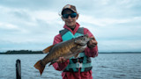
Feature image via Bryan Gregson
Shop
Shop AllSign In or Create a Free Account
Related

Fishing
All-Around Angler: How to Read Maps to Find Fishing Spots
Books & Literature
5 Must-Read Fly Fishing Books to Shake Off the Winter Blues