How to Improve Your Whitetail E-Scouting
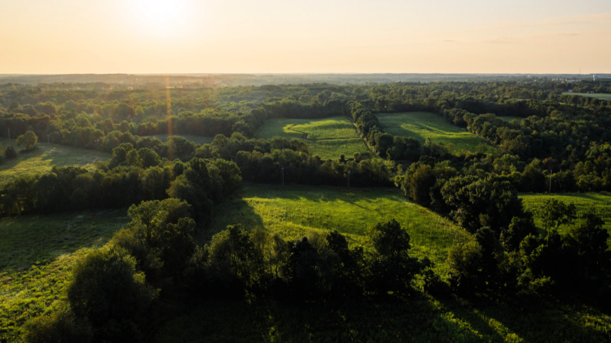

E-scouting, the act of using apps to scour satellite imagery in search of hunting hotspots, is a skill that needs honing. You can learn the basics of e-scouting by reading up on it,or by watching tutorial videos, but that’s purely academic. To truly level up your digital scouting game, you’ve got to take it from the comfort of your living room into the woods.
This is where you will ground-truth your findings, and either confirm your suspicions about a specific area or dispel them. Texas bowhunter K.C. Smith spends weeks each fall hunting public land in various states for his hunting brand, The Element. He relies heavily on e-scouting, but has learned that individual parcels, and the interesting spots in them, requireboots-on-the-groundconfirmation.
“We always try to identify multiple spots beforewe head out to a specific stateso that we have backup options,” Smith told MeatEater. “Inevitably, some of those spots, especially the backups, will look way better in person than they did on onX. This happens all of the time with native terrain.”
When Smith says “native terrain,” he means prairie grass,CRP, cattails, and pretty much anything else that isn’t cultivated on the landscape. When it comes to these types of cover, which are all crucial whitetail habitat, the appearance on a scouting app will be one of monotonous nothingness. This is easy habitat to overlook and totally write off, but when you step foot in it, the story of deer usage often becomes much clearer and often, far more compelling.
E-Scouting Mistakes We All MakeUnderstanding how to accurately read cover, from patches of swampy sawgrass to deciduous and coniferous forests, will help you immensely with your e-scouting efforts. Intentionally going back and forth between e-scouting and time in the woods exposes holes in your game.
These holes often come from scaling realities with satellite imagery.
This might include cover that appears to be small shrubs or bushes but is actually 10-foot tall willows or tamaracks, which is somethinga big woods huntermight encounter. Or, a southern whitetail junkie might e-scout an area with a grove of pine trees in it. The evergreens, planted in neat rows, might look like amazing bedding cover on your phone or tablet screen. In person, they could be 75 feet tall with an absolute pine desert beneath them, which is the kind of open habitat that no self-respecting buck would call home.
Smith has learned this the hard way through his travels, but also concedes that it’s a fact of life for nomadic deer hunters. “You have to prepare to get things wrong,” he said. “You have to understand that some of your hottest prospects will be duds in person, while some of your less appealing findings will actually prove to be the best when you’re there in person.”
E-Scouting WinsE-scouting isn’t always about getting things wrong. It’s possible to identify a likely river crossing, a pinch point in the hills, or some soft edge in the big woods, and then walk in only to realize that you nailed it. Sometimes, you pitch a perfect e-scouting game. The first time this happened to me, I picked out a tree on a tract of public dirt in Oklahoma, walked in, set up, and killed a deer from that very tree. It was revelatory and has happened a handful of times since then.
Spot-on e-scouting is a rarity, but it happens. More commonly, your digital efforts help you focus in on the right neighborhood. Then it’s a matter of in-season scouting, or observation, which will put you right on top of the deer action.
The key to these more favorable outcomes is practice. Whether you’reheading out for a shed huntor maybe a little winter scouting right now, take some time before you leave to look at aerial imagery of the property. Plan a route with it, and then pay attention to what you see when you’re in the woods. Ask yourself how closely your e-scouting hunches match your actual surroundings when you’re hiking through the woods.
Remember, too, that it’s possible to reverse engineer your boots-on-the-ground scouting to see what some spots look like on satellite imagery. I do this a lot, especially when I find a terrain feature that shows plenty of current deer usage. When I’m standing on a freshly discovered pinch point or deer highway, I pull up myonXto drop a pin. But, I also want to see how it looks on satellite imagery so I can file that away for future e-scouting efforts.
I did just this on a recent shed hunt in southwestern Wisconsin. What stuck out at me was how the funnels I found in thebluffy countryalong the river didn’t look all that special when viewed solely in satellite imagery. Once I overlaid the topo lines in each spot, they became much easier to read and understand.
This lesson is an important one. The latest scouting apps give you plenty of options to view the land, make notes, and keep developing a better understanding of these valuable tools. The more you know how to use the layers, and the information available through your chosen app, the more you can put it to practical use before you hit the woods, no matter where your whitetail addiction takes you.
Feature image via Captured Creative.
Shop
Sign In or Create a Free Account
Related

Scout
3 Ways To Improve Your Winter Whitetail Scouting
Scout
How to Scout Terrain Features for Whitetails