How to Find Buck Bedding on Aerial Imagery

You’ve graduated whitetail pre-school if you’re using satellite imagery to identify a buck’s destination food source. E-scouting for and successfully findinga mature buck’s bedding area is a different story. This is higher education stuff and starts with a 30,000-foot view of your hunting grounds, coupled with a strategy to verify your digital findings.
According to Minnesota bowhunting expertGarrett Prahl, mastering this process requires much more than simply firing up youronX appand checking out what the birds-eye view reveals.
“The first piece of the puzzle is always figuring out the kinds of habitat you’re working with,” Prahl said. “Whether you plan to hunt hill country, cattail marshes, river bottoms, or big woods tracts of timber, knowing what the cover consists of provides a solid starting point on what to look for.”
Habitat can vary wildly from county to county, and even section to section, but Prahl has a list of terrain features that always get his attention, regardless of surrounding cover. The specific things he looks for are points, benches, creek drainages, and any type of natural edge.
What Are You Really Looking At?
E-scouting cover like cattail marshes is a pretty simple process because you can usually see the delineation between types of habitat. In these environments, it’s a safe bet that bucks are going to choose points of cover that allow for multiple escape routes. Satellite imagery of river bottoms is also often a fairly easy read. Thick patches of riverside willows, islands of cedars in grassy terrain, and hard habitat edges all tend to be highly visible along waterways.
But what about bluff country whitetails, or deer that live in wolf territory where their entire home range consists entirely of unbroken coniferous forest? When it comes to these more difficult types of cover, Prahl does his best to scour imagery until he can tease out something actionable.
“When you’ve got miles of flat, timbered land, for example, everything looks the same,” Prahl said. “But if you really start digging in, you might find a 10-acre marsh or a 40-foot elevation rise, both of which could point you to a buck’s bedding area.”
An elevation rise of 40 feet will reveal itself if you’re using a topographical overlaywhile in 3D mode. This is the best way to truly see how the land folds. It will clue you into points with steep dropoffs, bluff-side benches, and barely perceptible declivity in otherwise level terrain.
No Elevation, No Problem
While whitetails love the advantages changes in elevation provide, they are also edge critters. Where two types of cover meet, you’ll often find travel routes, browsing areas, and according to Prahl, the kind of micro-diversity that bucks love to bed in.
“This might be where an old clear cut meets older growth forest, or where a marshy area butts up to just a little higher ground.”
These softer edges take a practiced eye to locate. You’ll want to zoom in on the imagery to look for subtle differences in foliage color and density. These blurred edges are often tied to small changes in elevation that might not be evident with typical 10-foot topo lines—meaning the ability to read cover is essential.
Once you’ve identified a soft edge, drop a few waypoints along its length to more clearly see how it fits into the greater landscape. After that, it’s time to get out and actually lay eyes on it. This is the final step to all in-depth e-scouting.
Ground Truth
In the case of clearly defined habitat points or small benches, it’s possible to call your shots when it comes to identifying core buck bedding areas via satellite imagery. In most cases, however, e-scouting will get you in the right neighborhood to build a boots-on-the-ground plan.
You’ll have to get out there and pay attention to not only the beds you find, butconcentrations of rubsin the cover nearest the suspected bedding areas. Finding specific bedding sites is the goal, but those rubbed-up zones will often point you to staging areas. Together, these two pieces of buck knowledge can really help you fine-tune a hunting strategy.
It also pays to think about what part of the fall bedding areas are likely to be used. Early season offers a foliage-density advantage, so bucks will often be found in more open cover. As fall progresses, they tend to shift to thicker cover. This is a generalization, butif you hunt pressured deer, you can bet on this happening.
The leaf drop coupled with added danger in the woods will often force bucks to abandon the open bench on a nice deciduous hillsidein favor of a thick CRP field, or maybe an overgrown homestead. This necessitates a long-game approach to e-scouting. Instead of focusing all of your efforts on finding the best bedding site on any given property, look to learn how bucks will use multiple areas throughout the fall in response to varying conditions.
Eventually your efforts should turn up several bedding locations that bucks will favor at different times throughout the entire season. This knowledge not only gives bowhunters a season-long advantage, but can offer a huge benefit to firearms hunters as well. Nothing pushes bucks into their most secure bedding areas like general firearm season.
Knowing their locations can keep you in consistent deer action when the rest of your hunting party is complaining about the lack of activity after opening day. And all of this starts with e-scouting.
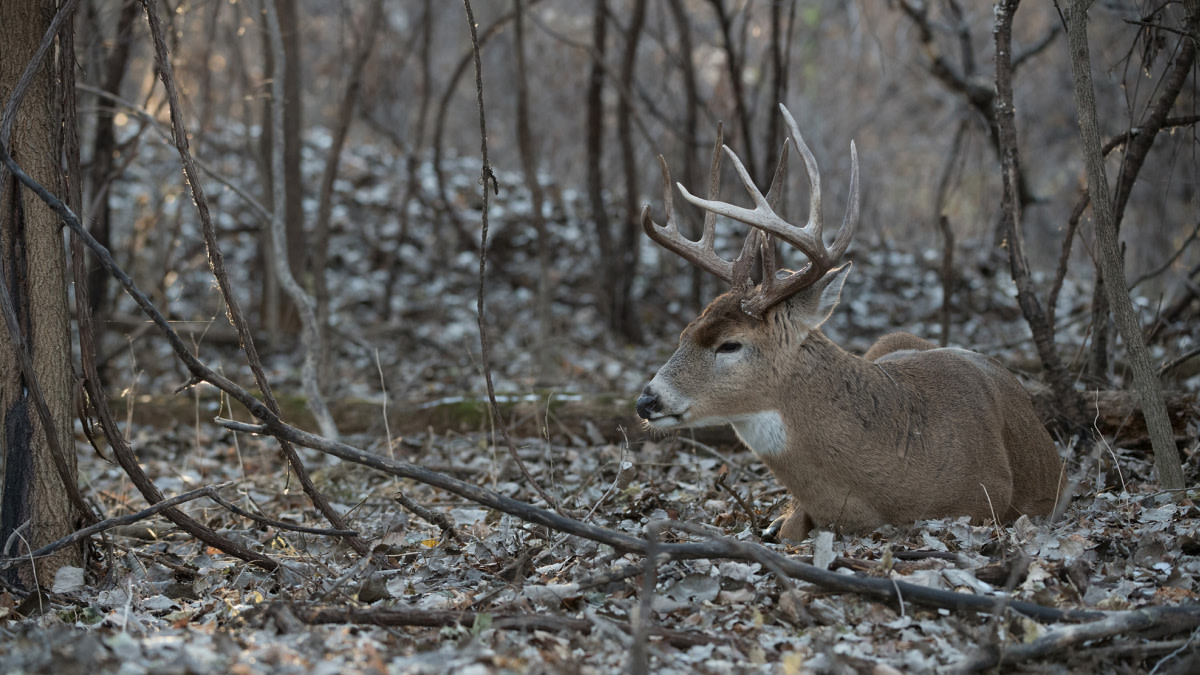
Feature image via Matt Hansen.
Shop
Sign In or Create a Free Account
Related
Scout
How to Find Whitetail Buck Bedding

Scout
How to Kill a Buck Hunting Rubs
