How to E-Scout for Public Land Whitetails

This time of year, chasing big whitetails couldn’t possibly feel further away. That doesn’t mean yourdowntime between deer and turkey seasonshould be wasted though. If you want to capitalize on the long offseason, now is the perfect time todownload onX,put your virtual boots on the ground, and start e-scouting. After all, success favors the prepared.
Locating Quality Public Land
When starting from scratch while looking for public land, there are a few specific things I like to keep in mind. The first may seem obvious, but I want to avoid public lands that are too close to populated areas. For me to consider diving into a new piece of public ground, it needs to be at least 30 minutes from any kind of metropolis. That’s not to say you can’t findhoney holes near urban areas, but it’s certainly tougher.
Next, you ideally want to choose an area that has multiple pieces of public land within relatively close proximity. In the event that your first option is a flop, it’s always good to have a plan B, C, and D within a short drive. Another tactic I like to use is targeting smaller pieces of public land. Most hunters will gravitate towards the large tracts, leaving smaller parcels of public overlooked. Some of my favorite big buck spots are less than 20 acres.
Locating Deer Sanctuaries
In general, deer have three basic necessities for survival: food, water, and security cover. Deer can find browse and drink damn near anywhere, and often visit those places after dark. Security cover, on the other hand, comes at a premium and is the only guaranteed area to find public land bucks in daylight. For this reason, my strategy always revolves around finding unpressured deer in places they feel safe.
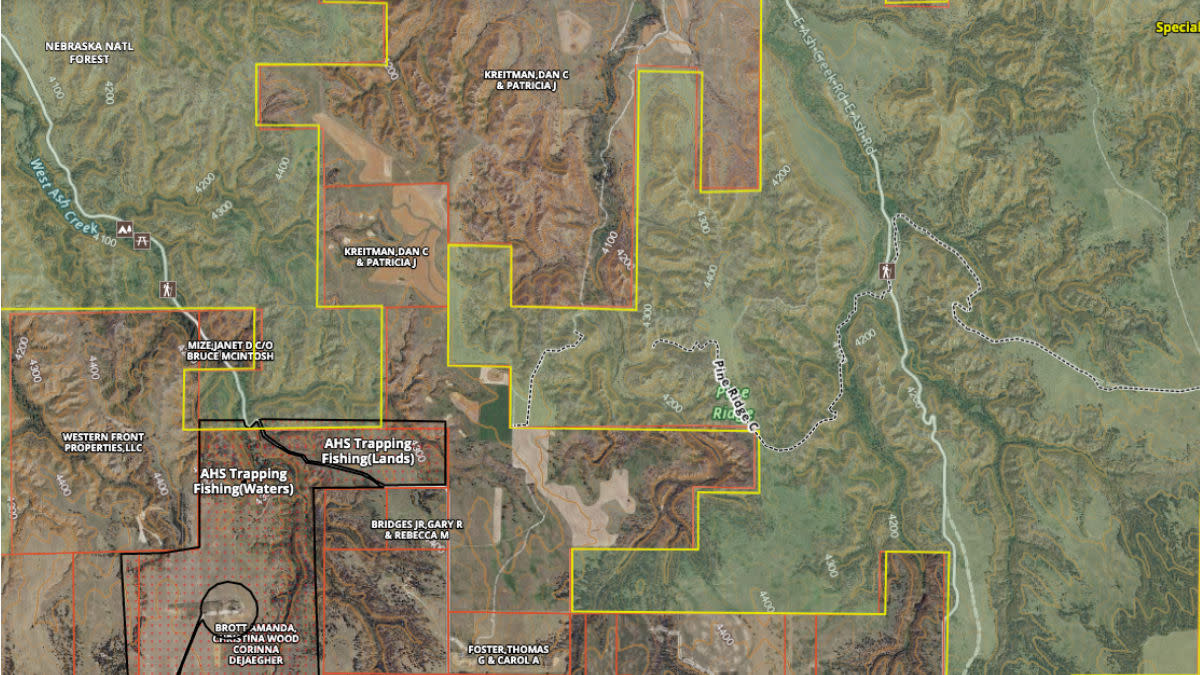
Digital scouting gives us the ability to quickly locate roads, parking areas, access points, and walking trails. If an area has too many of those things, cross it off the map. Instead, focus on parcels that have barriers to deter hunters—the opposite of easy access. Just beyond one of these barriers is where you’ll start to findunpressured deer.
A classic barrier is a very steep hill. Most hunters want to take the path of least resistance and would rather go somewhere else than carry gear across rugged terrain. Nasty ravines, even those close to roads, are some of my absolute favorite places to find deer sanctuaries. Barriers can also come in the form of water, thick vegetation, marshland, and private land. In general, the further you can get from a road and the harder it is to get there, the less likely you are to run into other hunters.
Locating Travel Routes
Once you find the spot within the spot, then it’s time to find the spots within that spot. This is when you can start to think about food and water. Food sources can come in many forms depending on habitat type. Utilizing onX, you should be able to quickly locate ag fields, meadows, burn areas, mast crops, and even urban areas with feeders and lush green yards.
If a certain food source is obvious to you, then it’ll be just as obvious to everyone else. For this reason, I don’t care for sitting on public landfood plotsor up against a private land ag fields. Instead, try to find less visible oak flats or limited water sources.
To identify bedding digitally, look for areas where whitetails will have both a visual and olfactory advantage. This occurs when the deer is able to bed with the wind at its back while maintaining a view of any approaching danger from the front. This often plays out on the upper third of a slope where deer have the ability to see any oncoming danger from below. When possible, deer also like to bed with thick cover to their back. This creates a feeling of security knowing that there is a wall protecting their backside.
If you’re able to find food and bed, then you’ll have an easy time figuring out travel routes. My personal favorite place to intercept whitetails is at a pinch point just off of bedding. Pinch points that focus deer movement come in many shapes and sizes, such as a drainage that intercepts a ridge, field, or other barrier. Like humans, deer naturally take the path of least resistance.
In this scenario, deer are more likely to go around the drainage rather than expending the energy required to go up and down the ravine. The narrow passage above the ravine, yet below the ridgeline, provides for much easier travel and is the ideal place to ambush a buck. If this funnel is located between bedding and food or water, then you’re in business.
Studying maps and digitally scouting new hunting ground is a surefire way to get a head start on next hunting season. By putting in the work now and eliminating unproductive earth months in advance, you’ll be one step closer tosuccess come November.
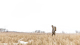
Feature image via onX.
Shop
Sign In or Create a Free Account
Related

Scout
How to Summer Scout for Public Land Whitetails

Scout
How to Scout Public Land Whitetails in the Offseason