How to Use Terrain and Topography to Hunt New Properties

You need to get hunting. Fast. Maybe you just picked up permission on a new property right before the season opens. Maybe you’re exploring new public land hunting spots and the rut is about to kick in. Maybe you lost access to your top spot and you’re now scrambling for new options. Whatever the reasons might be, learning to hunt a new property is a challenge, especially if you need to do it in a hurry.
That said, there are a number of ways to get to know a new property in a jiffy. I want to share a few thoughts on one such framework, in which you can use the basic principles of how deer use changes in terrain and topography to quickly pick apart a property and get hunting.
Why Terrain and Topography?Experience with local deer patterns. History in the area. Days of observation or long distance scouting. These are all luxuries that aren’t afforded to the hunter on a deadline in new territory.
For that reason, when on a tight timeline, it helps to focus on factors that are consistent no matter where you hunt, and that can be quickly identified and used to formulate a quick-start strategy. A perfect example of this is how deer use terrain and topography.
To make sure we’re all on the same page, when I say terrain and topography I mean the cover, physical features, formations, and changes in elevation of a given piece of ground. In many cases deer will relate to these changes in terrain or topography the same, whether you’re on a property you’ve hunted for years in Wisconsin or a brand new spot in Kentucky. For this reason, if you understand the basic principles of how deer use these features, you can apply this framework to understand and start hunting almost any new property.
Basic Terrain and Topography RulesTo put this strategy into play, you must first understand how deer use a few common land features. Wrap your head around these five basic terrain and topographic features and you’ll be well on your way to getting rolling on a new property.
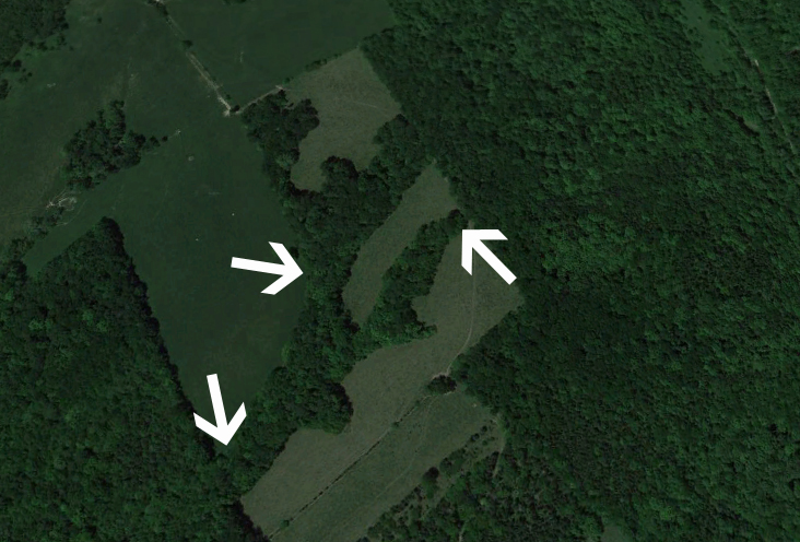
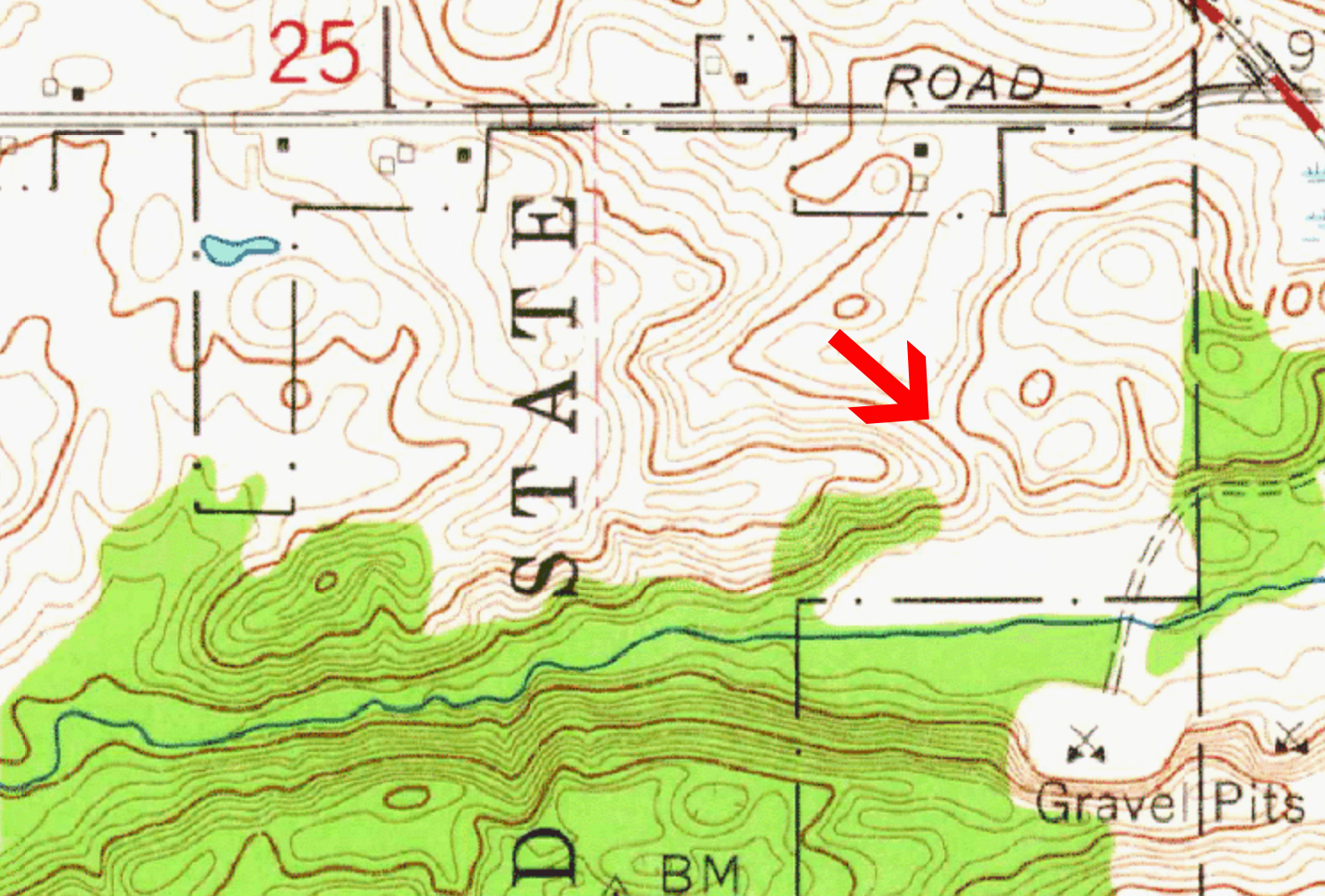
Cover Funnelsare some of the best and most popular spots to hunt whitetails, and for good reason. When cover such as thick brush, tall grass, or timber is pinched down into a narrow area, it will funnel deer movement into this same narrow region. Most deer, especially mature bucks, prefer to avoid traveling in the open. Therefore anytime the available cover is necked down you can enjoy a better than average chance of catching deer moving through it. These funnels work especially well during the rut, when bucks are traveling from doe bedding area to doe bedding area, looking for a gal ready to mingle. In the photo below you can see several examples of cover related funnels.
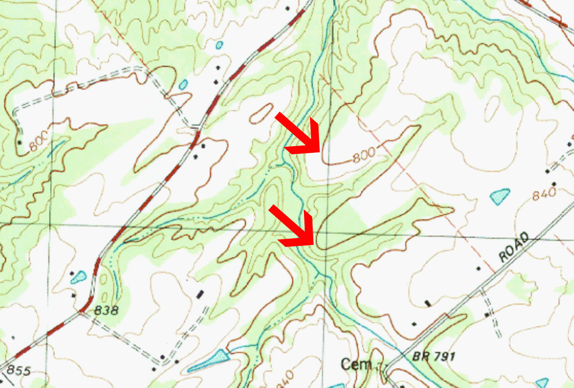
Edgesare another terrain feature that produce consistent use by deer. Edges can come in many forms, but most generally these are edges between two different types of terrain or cover. For example, an edge of timber where it meets a CRP field. Or the edge of a swamp where it meets high ground. Or maybe the edge of a recent clear cut where it hits an open hardwood forest. Whenever an edge is created between two distinct habitats, deer will be attracted to it and travel along it. You can oftentimes identify edges such as this by studying aerial maps of your property, for example take a look at the edges in the image above.
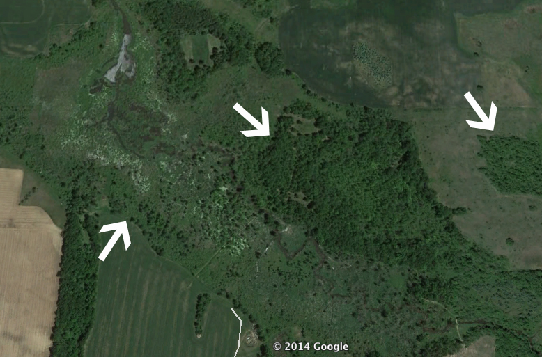
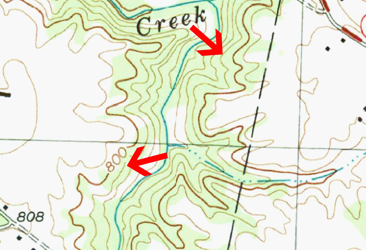
Saddlesare another type of funnel, but rather than being created by cover, saddles are created by a change in topography on a ridge line or hill. Imagine a ridge with a small dip in the middle of it, this is a saddle. Deer naturally prefer traveling on the path of least resistance and when a low spot in a ridge or hill is present, it provides deer a naturally easier way to cross. When looking at a topographical map, once you know what to look for, saddles will stand out clearly. See the example above.
Pointsextending off a ridge or hill also can create a funneling effect that hunters can take advantage of. You’ll find deer consistently using points in two ways. First, deer will often use these points to bed on. Deer love bedding with a wind at their back coming from the ridge, and then facing down into the lowland ahead of them, keeping watch for danger. In addition to use as bedding, you’ll also find that deer will use trails running along either side of a ridge which will then come together at the end of a point when heading down towards lower ground. At these points of intersection, a funneling effect is created as larger numbers of deer pass through this one specific area at the end of the point. Topographic maps show these points quite clearly.
Ridge lineswill be used by deer as a travel corridor in a consistent fashion. In most cases, deer will travel not on top of a ridge, but rather about 3/4 of the way down the side. This position of travel allows them to avoid being skylit and easily seen on top of the ridge. And as noted above, you’ll find these trails work towards the point coming off the end of the ridge, and then they will cross at the point. You can also find benches, essentially flat spots part way up a ridge, which will funnel deer movement as well. On a topo map, ridges will look like long consistent lines stacked tightly on top of each other.
How To Use These Terrain and Topography RulesSo now that you’ve got a basic understanding of how deer use the “Big Five” terrain and topographic features, it’s time to put them to use in learning a new property fast. Sticking with the theme of fast, to make this tactic work, you simply need to follow this quick three step process.
1. Study Maps:Pull out aerial and topo maps of your hunting properties and mark every instance of one of the “Big 5” features we’ve talked about.
2. Speed Scout:Once you’ve got your “Big 5’s” identified, it’s time to head to the field. If you have time, do a quick check of as many of these spots as possible to verify whether or not there is sign of the deer activity you’d expect, given the terrain and topographic features. You may even want to place trail cameras in some of these locations for further information.
3. Hunt:If you had time for a fast scouting trip, you should now have an idea of which of the “Big 5’s” look most promising. Now you hunt. Even if you didn’t get a chance to scout, by setting up on these terrain/topo features that consistently funnel deer movement, you should have a good headstart on being in on the action.
Get HuntingAnd that’s it! We could go into much more detail on all of these topics, but we won’t. Why? Because you need to hunt fast. And when you’re hunting fast, you simply need to understand the basic principles and then act on them.
Terrain and topography influence deer movements in consistent ways. So remember that and use this simple fact to your advantage by identifying those features and hunting the assumed deer travel. When you’re in a pinch and need a fast strategy, this is a great place to start.
Interested in more information on how deer use terrain and topography? I’d highly recommend you check out Bill Winke’s book “Trophy Terrain: Creeks & Ditches” and Brad Herndon’s “Mapping Trophy Bucks”.
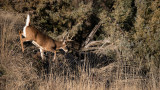
Feature image via Matt Hansen.
Shop
Sign In or Create a Free Account
Related
Hunt
Understanding Terrain for Deer Hunting Success
Scout
How to Scout Terrain Features for Whitetails