How onXmaps Is Creating More Public Land Access


Public land hunters are facing a dilemma. Conservation organizations and state agencies in recent years have issued dire warnings about the declining percentage of Americans who hunt. At the same time, those who hunt and recreate on public lands have observed increased traffic, andCOVID-19has only exacerbated complaints of overcrowding.
Some haveproposedscaling back hunter recruitment efforts, but there’s another obvious solution: increase the acreage of accessible public lands.
Easier said than done, you might say. ButonXmapsand theTheodore Roosevelt Conservation Partnershiphave catalyzed a movement that could provide access to more than 16 million acres of public land. This land is already owned by the public, but because it’s surrounded by private parcels, it’s not legally accessible. These areas are what these organizations describe as “landlocked.”
MeatEater highlighted this problem on the flagship podcast when onX launched #projectlandlocked in 2018. Since then, the mapping company has issuedfive additional reportshighlighting the fact that this isn’t just a problem on public lands in Western states.
OnX identified 174,000 acres of landlocked public lands inSouthern states, 80,000 acres inMid-Atlantic states, and 303,000 acres in theUpper Midwest. In addition, they found 6.35 million acres ofstate-ownedlandlocked lands in Western states along with the 9.52 million they found onfederal land.
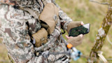
Hunters across the country are the legal owners of this ground as American citizens, but they can’t access it without a helicopter. There’s a growing demand to give these hunters what they paid for and, maybe, ease the overcrowding and recruitment dilemma that has plagued the outdoors community.
How Do Public Lands Get “Landlocked”?OnX defines landlocked public lands as those parcels that are “surrounded by private land with no public route that either touches the edge of that public land or goes into or across that land,” according to onX Access Advocacy Manager Lisa Nichols. The mapping company has developed an automated analysis that combs through its data to identify landlocked areas. OnX analysts perform quality-control tests to make sure the program is working properly.
Public lands became landlocked through a variety of means, but the bulk of the issue derives from government initiatives from the 1860s onward to spur the country’s westward expansion. To incentivize railroad companies to build transcontinental tracks, Congress passed a series of land grants that gave the builders 10, 1-square mile parcels for every mile of track they laid. Federal officials often granted this land in checkerboard patterns with the railroad receiving odd-numbered blocks and the federal government retaining the even. The thinking was that those remaining federal blocks would increase in value after the completion of the railroads to later be sold or homesteaded.
At the same time, under the Homestead Act of 1862 Americans were allowed to claim and “prove up” 1-square-mile parcels of government-owned lands in the West. Some of those efforts succeeded and became successful ranches, but many failed and later reverted to government control. Both pathways led to the checkerboard of public and private ground we know today.
Enterprising hunters have tried to move from one public parcel to the next where the parcels touch at the corner, but this practice remains inlegally dubious territory. While the legal question still lingers in many states, and may soon betested in Wyoming, onX defines these checkerboard lands as landlocked.
However it happened, Nichols said, public lands don’t usually become landlocked through intentional action on the part of the landowners.
“It’s just the way that history happened,” she explained. “There are certainly landowners that might purposefully buy up different chunks of land to gain exclusive access. But that is probably less than a tenth of a percent of the landlocked lands that we’ve found.”
Not Just a Western IssueHistorical and geographical realities have dictated that Western states contain a good deal more public lands—and landlocked public lands—than their counterparts in the East. But that doesn’t mean states in the East and South are immune from the issue.
As part of their efforts to galvanize a national response, onX has published landlocked reports on theSouth, theMid-Atlantic, and theMidwest. Nichols believes anyone who enjoys the outdoors in these areas should be even more concerned than Western residents about this issue.
“They don’t have as much public land in general,” she pointed out. “And it’s not just impacting hunters. It’s also impacting people who just want to go outside. It impacts the entire experience of going outside if there were more places that the public could access.”
In the South, onX and TRCP identified 75,000 acres in Florida, 49,000 acres in North Carolina, 28,000 acres in Arkansas, and 22,000 acres in Tennessee that lack permanent public access.
In Tennessee, for example, 550 acres of national forest land are landlocked because they are surrounded by private land and fall along the western slope of Holston Mountain. In the entire state, Tennessee hunters have access to only about7,000 public acres.
The same story is true in North Carolina, where there are 150 acres of landlocked public land in the Uwharrie National Forest. This might not sound like much, but considering the fact that onlyabout 7%of the state’s total landmass is held by the public, outdoorspeople in the Tarheel State should be looking to take advantage of every single acre.
You can find similar examples in onX’sother reports. In New York, there’s an inaccessible 600-plus-acre parcel of the Flat Rock State Forest filled with game animals. In Minnesota, two parcels totaling 600 acres would give anglers access to over 1,000 feet of shoreline on North Long Lake. In Wisconsin, a cluster of landlocked areas totaling 525 acres are sitting right next to a state wildlife area and a county forest.
These parcels aren’t large, especially when compared to the millions of acres in the West. But for the hunters and anglers looking for a place to pursue game in largely private land states, 600 acres is a hell of a lot better than nothing.
What’s Being Done and What Can You Do?The crucial first step to addressing this issue is already well underway. Public land hunters have long known about landlocked land in their areas, but without a national sense of the problem, it has been difficult to galvanize support among the general public or lawmakers.
Thanks to onX and TRCP, the true scope of this problem is clear to anyone willing to listen. Nichols believes their reports played a role in the passage of theGreat American Outdoors Act, which funded access initiatives via the Land and Water Conservation Fund (LWCF).
“Since we first launched the Western federal lands report in 2018, we’ve seen the impact of so many people getting educated on this topic. Seeing the numbers put it on people’s radar, and a lot of energy was generated,” Nichols said.
The LWCF earmarks $27 million annualy for access initiatives. As Nichols put it, providing access to landlocked land offers a great “bang for the buck.”
“The agencies and organizations working on this issue are always looking for easements and small parcels of land that would make a connection between a public road and a landlocked public land,” she explained. “There are so many opportunities where the public land is a few hundred feet away. Those are the ones that provide the biggest bang for the buck.”
Unfortunately, money is often the key to securing access to landlocked areas. Easements or entire parcels must be purchased from or traded with landowners, so sending a few bucks to your favorite public lands organization is an easy way to make an impact.
OnX runs a grant program, and Nichols explained that this money is often used to identify and secure easements that are at risk of disappearing. Landowners sometimes operate on handshake access deals that provide public access free of charge. If that owner decides to sell, that access disappears. Grant programs can identify and secure access through those parcels before they change hands.
The response of the landowning community to #projectlandlocked has been mixed, Nichols said. Some acknowledge the problem and want to help while others don’t want to give up their exclusive access to landlocked public lands. In either case, it’s crucial that hunters and anglers gain or maintain the support of these landowners and avoid turning the issue into a crusade against private landholders.
Neither the government, conservation organizations, nor hunters can force a landowner to sell a parcel or an easement. Opening landlocked lands will necessarily require buy-in from landowners, and Nichols encouraged hunters and anglers to do everything they can towards that end.
“Be overly respectful of landowners and be very aware of the challenges that they face when there are so many more people on the landscape during hunting season. Nobody wants to be cast in a bad light because of another bad apple,” she said.
Just Getting StartedThe Great American Outdoor Act and subsequent access funding was a huge win, but there are still access initiatives that deserve support from the hunting community.
On the federal level, the MAPLand Act could be a gamechanger. This piece of legislation passed out of the House of Representatives on March 15 with an overwhelming, bipartisan majority vote of 414-9. As we’vepreviouslydiscussed, the MAPLand Act would, among other things, providing funding for public land agencies to digitize records of easements or rights-of-way across private lands. This data could then be shared with companies like onX to provide hunters with information about previously unknown access points.
“If someone doesn’t have access to the information, they don’t have access to that piece of public land,” Nichols pointed out.
Hunters should also be aware of and support the access programs in their state. OnX’s reports outline the programs in each covered state that provide funding for projects to give the public more access.
In Wisconsin, for example, the Knowles-Nelson Stewardship Program provides millions of dollars to allow the Department of Natural Resources to unlock Wisconsin’s state parks, wildlife and fisheries areas, and state natural areas. The program is set to expire this year, and new bills by Wisconsin legislators would allow the state to sell off lands gained under the program. If you live in Wisconsin, consider this a call to action.
No matter where you live, you can do three things right now to help unlock landlocked public land in the future: 1) donate to and support a public land nonprofit like the Theodore Roosevelt Conservation Partnership, 2) contact your U.S. representatives and voice your support for the MAPLand Act, and 3) learn about and support the programs in your state that acquire new public lands.
Those hunters who worry about overcrowding should be especially keen to open access to landlocked public land. It’s not a silver bullet, but it’s the most natural place to start.
Shop
Sign In or Create a Free Account
Related
Public Lands & Waters
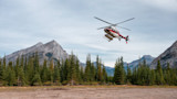
Helicopter Hunting Stirs Public Land Access Debate

Public Lands & Waters
Ranch Owner Claims Over $7 Million in Damages in Corner Crossing Case